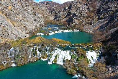
The cultural landscape area of the Krupa River is bordered to the south by the Zrmanja River and the Žegar Field, to the east by the source of the Krupa, to the north by the foothills of Velebit, and to the west by the confluence of the Krupa and the Zrmanja. Spanning approximately 23 km², the entire area is located within Velebit Nature Park and encompasses parts of the settlements of Kaštel Žegarski, Krupa, and Golubić, while administratively it belongs to the City of Obrovac.
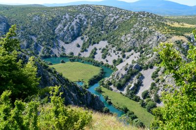
The cultural landscape of the Krupa River is situated on the northern edge of Bukovica and forms part of the North Dalmatian karst plateau, deeply incised by the canyons of the Zrmanja, Krupa, and Krnjeza rivers. The settlements are scattered, with numerous smaller hamlets developed around meadows along the river and fertile valley bottoms of various sizes.
The cultural landscape of the Krupa River is listed in the Register of Cultural Goods of the Republic of Croatia – List of Protected Cultural Goods.
The system of protection measures for this cultural asset is implemented through zoning of the landscape, designating "Zone A" and "Zone B".
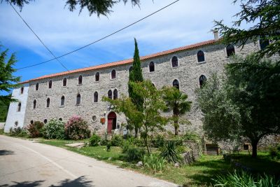
Protection in "Zone A" provides full conservation of natural and cultural-historical values, ensuring the greatest possible respect for tradition and the functional integrity of spaces and structures. This applies to the areas encompassing the Krupa River, its tributary the Krnjeza, the Zrmanja canyon with river harbors up to the Uljebrka mill and Donji Bridge. Within this protection zone are several elements of cultural and natural heritage: the Krupa Monastery, the bridges near the monastery, Kudin Bridge and the remains of the old mill, Donji Bridge and mill in Kaštel Žegarski, local hillforts, mills, tufa barriers and steps at the waterfalls, and others.
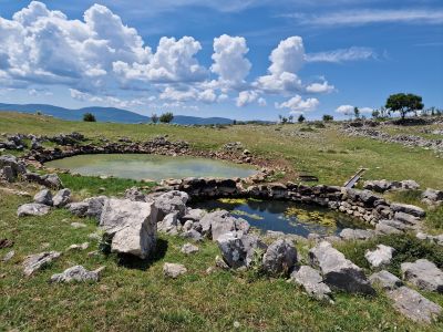
Protection in "Zone B" involves partial conservation of historical structures and applies to the area including part of the Golubić Centar – Zagradine settlement, which features several elements of the cultural landscape such as the Veselinović Hillfort, the dry-stone boundary wall dating from the early Roman period, prehistoric ramparts below the boundary wall, Grčka Lokva (the 'Greek pond'), and others.
